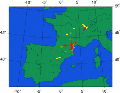
Thunderstorm Outlook: Mon 5 - Wed 7 September
 A persistent thunderstorm situation is taking place over southern France today and tomorrow. Slow-moving systems with strong lightning activity have developed since the afternoon and due to cyclogenesis (formation of an own low pressure area), the storms will stick and return over the area. Fuel to sustain storms is provided by the cold upper airmass that is advected over an inflow of Mediterranean moisture rising over the southern slopes of the Massif-Central.
Currently (Mon 22:25), the system is very well positioned for observation by our cameras, but both are covered in cloudiness. The waiting is for the cloud deck to lower or dissolve near Pic du Midi, not impossible. Let us hope we will get a clear sky sometime these nights, we haven't been very fortunate this summer with the clouds when good storm systems were nearby.

0 Comments:
Post a Comment
<< Home